Brandywine Creek
Brownfields Area Wide Plan
Client
City of Wilmington
Location
Wilmington, DE
Years
2018-2021
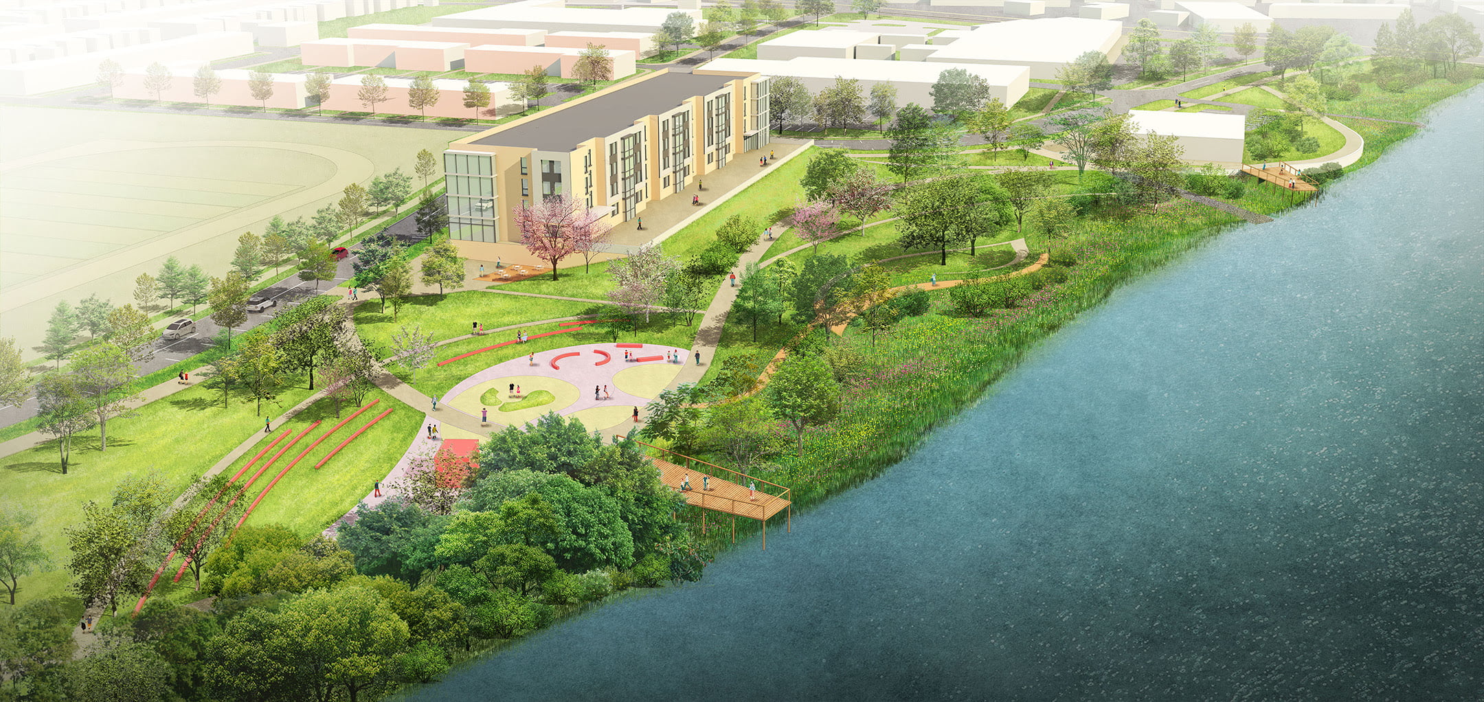
The Brandywine Creek Brownfields Area Wide Plan, Twelfth Street Connector Study, and U.S. EPA Assessment projects, all conducted since 2018, focus on the Price’s run/Northeast neighborhood and adjacent neighborhoods on the northern side of Brandywine Creek in Wilmington, Delaware.
Funded by U.S. EPA brownfields grants, the projects created an extensive inventory of brownfield sites in the neighborhood, identified possible connections and redevelopment opportunities, and address the increasing severity and frequency of flooding in the area. Outcomes included a joint effort with WILMAPCO to assess the viability of a 12 th Street connector, which will provide access to major catalyst brownfields and position the area for positive economic investment; reuse planning for the former Diamond State Salvage site including a living shoreline along Brandywine Creek; and mixed-use development. Additional improvements include the extension of the regional multi-use trail along the Brandywine and the creation of a nature-based waterfront park that transitions into the living shoreline. Work focused on the former Diamond State Salvage site is ongoing with special focus on a resilient edge in the wake of the devastating flood caused by Hurricane Ida in September 2021.
Services
Urban Design
Brownfields Reuse Planning
Parks, Recreation, & Green Space
Resiliency, Green Infrastructure, & Landscape Utilities